Step-by-Step: Making an Edible Map
We had so much fun last week making our edible map. However, y’all really did give me too much credit because it was really easy. First of all – oh, here’s the part where my creativity credit takes a nose dive – it wasn’t a cake. I bet you could make the map with a cake, but we used sugar cookie dough.
Yep, Pillsbury.
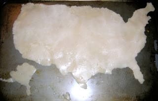
It did look like a cake, though, from the angle at which I took the picture.
Really, it was easy.
Supplies for making an edible map
- Refrigerated sugar cookie dough
- Wax paper
- Sharpie marker
- an outline map to trace
- Icing and food coloring
- a knife
- any other candies you’d like to use to embellish your map (think: rivers, country border lines, capitals)
How to make an edible map cookie
Step 1: Trace the map outline onto wax paper.

Step 2: Turn the wax paper with the traced side down so that your map dough is a mirror image of the country outline.

Step 3: Shape the dough. Then, flip it over onto a cookie sheet so that it is now representing the actual shape and orientation of the country you’re making.

Step 4: Bake according to package directions. Let me make a few important notes here.
First: If you have smaller outlying areas (in our case Alaska and Hawaii), you might want to bake them separately because they will get done much faster. Trust me on this one.
Second: You may need to bake your cookie longer than directed so that the center gets done. We had to add additional time.
Third: Sugar cookies puff up a lot. Which caused us to need to add Step 5.
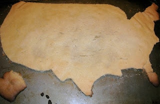
Step 5: Your cookie has probably puffed up enough that it hasn’t retained the original shape that you were going for. We placed our wax paper outline back onto the cooled sugar cookie and used a knife to cut the shape out of the baked cookie.
Looking back, it probably would have been just as effective to spread the cookie dough out to completely cover the cookie sheet and bake it all like a pan cookie, then, cut the shape out at the end.

Step 6: Ice the cookie and add any candy embellishments that you desire. Take some pictures to share, then…enjoy!

Yes, the Great Lakes are green. I didn’t realize that we were out of blue food coloring until we got ready to add the icing.
This article was written by Kris Bales–the previous owner of Weird, Unsocialized Homeschoolers.
Kris Bales is a newly-retired homeschool mom and the quirky, Christ-following, painfully honest founder (and former owner) of Weird, Unsocialized Homeschoolers. She has a pretty serious addiction to sweet tea and Words with Friends. Kris and her husband of over 30 years are parents to three amazing homeschool grads. They share their home with three dogs, two cats, a ball python, a bearded dragon, and seven birds.


this looks great, Kris!
drop me a line if you do one out of chocolate, next.
Now THAT is a fun way to do geography!
Hey … that is REALLY cool! 🙂
LOVE it!
Can we come to your house to do school work?? LOL
peace!
That looks way fun!
fabulous idea!
I found a recipie on the internet for non-spreading cookie dough, I use it for christmas cookies, and people are stunned, I tell you, stunned that I can make such perfectly shaped cookies!
google ‘no fail sugar cookies’ if you would like to find it!
@inklenaomi — Thanks for that tip. I’ll be sure to look for that next time…maybe. If I don’t take the easy way out and do the Pillsbury dough again. lol
Cool! We’re definitely going to do this!!!
Fun idea! thanks for sharing your tips!
I’m planning a summer “school” activity of a world geography unit study and this, as well as your Rice Krispie Treat map-making will definitely be part of it. Thanks for sharing.